 The Pacific War Online Encyclopedia
|
| Previous: Saipan | Table of Contents | Next: Saito Masatoshi |
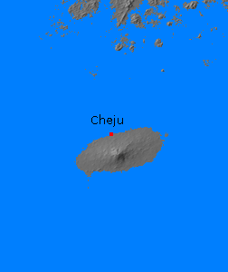
The island the Japanese called Saishuto, which was known in Korean as Chejudo (Jeju-do) or to Westerners as Quelpart Island, is located about 200 miles (320 km) south of the southwest tip of the Korean peninsula. It is about 45 miles (70 km) long and 25 miles (40 km) across, with a total area of 714 square miles (1850 km2). The island is the tip of a large shield volcano, which rises to a maximum elevation of 6400' (1950 m) at Mount Auckland (Hallasan) at the center of the island. The last recorded eruption was a flank eruption in 1007 C.E. The island has a mild subtropical climate with ample rainfall.
The island had a small port at Cheju (Jeju; 126.499E 33.489N). Its location on the sea lanes from Hokkaido to western Korea and northern China gave it some potential value for an Allied blockade of Japan, and the Japanese activated 58 Army for its defense on 8 April 1945.
References
Global Volcanism Program (accessed 2012-7-11)
The Pacific War Online Encyclopedia © 2012 by Kent G. Budge. Index