 The Pacific War Online Encyclopedia
|
| Previous: Chiba | Table of Contents | Next: Chicopee Class, U.S. Fleet Oilers |
 |
|
U.S. Air Force. Via ibiblio.org |
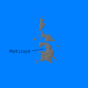
Chichi Jima (142.194E 27.080N) is an island in the Bonins south of Honshu. The island is about five miles (7 km) long and has a sizeable anchorage at Port Lloyd (Ogasawara-mura), but its rugged terrain hindered development of an airfield.
Ironically, the island was first settled by a group of Hawaiians led by two Americans, Aldin Chapin and Nathaniel Savory, who established a trading post for New England whalers in 1830. The island was purchased by Commodore Perry on 15 June 1853, but his action was repudiated by the Pierce adminstration and the Japanese annexed the island in 1861. The American colony was left undisturbed and Japanese immigrants did not began to arrive in large numbers until 1887. The Japanese established a small naval base here in 1914, and the island remained the most heavily garrisoned in the Nanpo Shoto until the Americans seized the Marshalls in early 1944. The garrison included a heavy artillery fortress regiment.
At the time war broke out, the anchorage was the assembly point for Guam Invasion Force.
The island was hit hard from the air during the Iwo Jima campaign, and was bombarded by Cruiser Division 5 (Smith) on 5 January 1945. However, the island remained in Japanese hands throughout the war, since it was unsuitable for rapid airfield construction and Allied reconnaissance revealed that it was heavily fortified.
References
Morison (1959)
The Pacific War Online Encyclopedia © 2007, 2011 by Kent G. Budge. Index
