 The Pacific War Online Encyclopedia
|
| Previous: Kusaba Tatsumi | Table of Contents | Next: Kusaka Junichi |
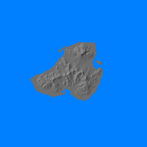
Kusaie (Kosrae; 162.98E
5.32N) is a mountainous
island in the eastern Carolines.
Rugged and heavily forested, It is about 8 miles (13 km) long with a maximum elevation of 2080' (634 meters) and is surrounded by
a fringing reef. The island has a
decent anchorage, and the Japanese stationed a garrison here, but
the airfield was never brought
into operation and
the island was bypassed by the Allies.
References
Morison (1951)
The Pacific War Online Encyclopedia © 2008-2010 by Kent G. Budge. Index