 The Pacific War Online Encyclopedia
|
| Previous: Takikawa | Table of Contents | Next: Tama |
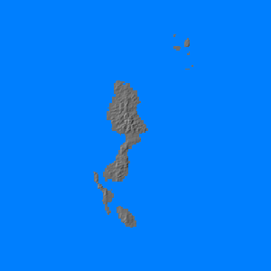
Talaud (126.76E 4.09N) is a group of islands located roughly halfway between Morotai and Halmahera to the southeast and Mindanao to the northwest. The main island is almost 40 miles (65 km) long and about 10 miles (15 km) wide. The islands are mountainous and were largely undeveloped in 1941, but there were potential airfield sites, and MacArthur planned to seize the islands on 15 October 1944 for airbase construction in support of later landings in Mindanao. However, the entire schedule for returning to the Philippines was moved up at the OCTAGON conference, and the invasion was canceled after a reconnaissance by Alamo Scouts on 20-21 September determined that there were about 1000 Japanese troops on the island.
References
Cannon (1953; accessed 2012-6-30)
The Pacific War Online Encyclopedia © 2012 by Kent G. Budge. Index