 The Pacific War Online Encyclopedia
|
| Previous: Bingham Canyon | Table of Contents | Next: Birdum |
Bintan (104.528E
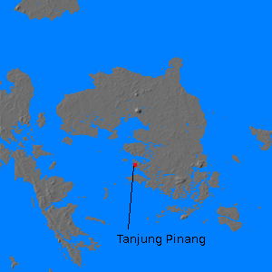
0.842N) is an island located southeast of Singapore. The island is a little over 30 miles (50 km) across, with an area of 314 square miles (813 km2).
The terrain is mostly level, but with a prominent hill, Bintan Besar,
which is the high point of the island at 1180' (330 m).The island had bauxite deposits producing about
434,000 tons per year, and much of the forest cover had been cleared for rubber plantations. The island also had an excellent sheltered anchorage. The chief settlement is Tanjung Pinang (104.447E 0.918N).
The island was controlled by the
Dutch in 1941, and when war broke out in the Pacific, the island was defended by Riouw
and Dependencies Battalion.
References
Japanese Monograph #68 (1942; accessed 2013-9-6)
The Pacific War Online Encyclopedia © 2008, 2013 by Kent G. Budge. Index