 The Pacific War Online Encyclopedia
|
| Previous: La Salle Class, U.S. Transports | Table of Contents | Next: Lackland, Frank D. |
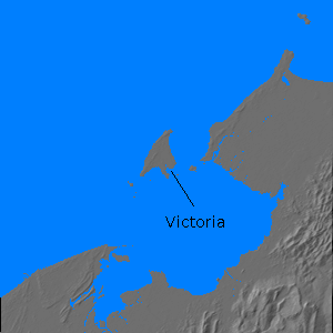
Labuan (115.24E 5.28N) is a small island in the mouth of Brunei Bay in British North Borneo. It had been a British possession since 1846. With an area of 35 square miles (91 km2), its port of Victoria had only basic facilities. It had an airfield and a small coal mine whose importance had diminished as ships switched from coal to oil as fuel. The population in 1941 was about 8960 persons.
The island was occupied by elements of 35 Brigade on 3 January 1942. It was recaptured by two battalions of Australian 24 Brigade on 10 June 1945. The Japanese retreated into "The Pocket", a stronghold in a mangrove swamp at the head of the harbor, and it took until 21 June to reduce the stronghold. The fighting cost at least 400 Japanese killed and devastated Victoria.
Climate Information:
Elevation 58'
Temperatures: Jan 86/76, Apr 89/76, Jul 88/77, Oct 87/76, record 96/59
Rainfall: Jan 9/4.4, Apr 15/11.7, Jul 15/12.5, Oct 21/18.3 == 140.6" per annum
References
The Pacific War Online Encyclopedia © 2007, 2010 by Kent G. Budge. Index