 The Pacific War Online Encyclopedia
|
| Previous: Sitka | Table of Contents | Next: SJ Surface Search Radar |
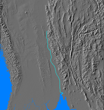
The Sittang River arises at the western edge of the Shan Plateau and flows south into the Gulf of Martaban. Its basin is separated from the Irrawady by the low Pegu Yoma mountain range. The river is unnavigable at all times of the year due to a strong tidal bore and swift currents, though its volume increases with the monsoon, and timber is floated downriver. The river does not carry nearly as great a burden of silt as the Irrawady, making its basin considerably less fertile. The lack of silt and the tidal bore have prevented the formation of a significant river delta.
The Sittang Valley was fairly prosperous and densely
settled in 1941, though much of it was flooded from June to October due
to the monsoon.
The lower Sittang is unfordable and was therefore a
significant military barrier, both in 1942 during the first Burma campaign and in 1945 during the
final Burma campaign.
Sittang Bridge. The British
destroyed the bridge across the lower Sittang on 23 February 1942 in an
effort to stop the Japanese invasion
of Burma, only to trap their own 17 Indian
Division on the far side. Most of the men were able to get back across
the river, but without their equipment the division was hors de combat. This
spawned a lasting controversy over whether the bridge was blown
prematurely, with those defending the decision pointing out that the
bridge was already under Japanese sniper fire as it was wired for demolition. The commander of 17 Indian Division, John Smyth, was relieved shortly thereafter, though this was partially due to his ill health.
Battle of the Sittang Bend. In July 1945 the Sittang valley became the location of the last significant land battle of the Western powers in the Second World War. The remnants of 28 Army had been trapped in the Pegu Yomas hills, and the Japanese attemped to break the survivors out across the Sittang and escape into Thailand. By now the Burmese National Army under Aung San had switched sides (becoming the Burma Patriotic Army) and was hunting down Japanese patrols and foraging parties. 33 Army attempted to assist the breakout, but its attack on the Sittang Bend (96.871E 17.461N) on 3 July 1945 was mistimed, taking place too soon before 28 Army made its advance to the river. The British were also helped by superb intelligence from captured documents that pinpointed the exact points where the Japanese would attempt to break out, allowing them to concentrate their firepower and virtually annihilate 28 Army.
On 2 July 1945 a Gurkha patrol bested
a small Japanese force and captured a dispatch bag containing, among
other things, the complete operational plan for the Japanese breakout.
The Japanese planned to advance to the Sittang in three columns, under
strict rules of engagement forbidding use of firearms in favor of the bayonet and forbidding any radio communications until they had crossed the Sittang by bamboo raft. Sakurai underestimated the British strength arrayed against him but believed he could get half his force across in fighting shape.
One of the routes of march lay directly across 17 Indian Division's headquarters at Penwegon (96.566E 18.222N), and Messervy reinforced the critical sector with 64 Indian Brigade from 19 Indian Division. The intelligence was quickly distributed among the British forces, which had two weeks to prepare to repel the breakout. The result was what Allen (1984) has described as a "gunner's war."
The battle was a miserable affair for both sides, taking place in pouring monsoon rains. Amply forewarned and with plenty of time to prepare, the British set up two killing grounds for their artillery and aircraft, one between the Yomas and the Sittang, and the second between the mouths of the Sittang and Salween
Rivers. The Japanese were allowed to advance from the Pegu Yomas to the
Sittang, then were hit with artillery and aircraft, while the
now-Allied Patriotic Burma Forces would deal with any survivors on the
east bank of the Sittang.
54 Division was already fighting two implacable foes before even stepping off from the Pegu Yomas: cholera and plague. As it crossed the flooded ground to the Sittang on 20 July, British guns already registered on the routes the Japanese would take took a fearful toll. Of 9000 men that started the march, less than 4000 made it to the Tenasserim. 55 Division ran straight into the British strongpoint at Penwegon and did not make it to the Sittang until 7 August. British agents on the far side of the Sittang continued to call down artillery fire on the Japanese as the survivors attempted to reform and move south. The division had already lost 3000 men in the Arakan, and another 5000 were lost breaking out across the Sittang.
Oddly enough, the unit that suffered the lowest percentage of casualties (though still appalling) was 105 Independent Mixed Brigade,
a scratch force of hodgepodge rear area units and impressed civilians
that started with 4173 men and got more than 2000 of them across the
Sittang. On the other hand, 13 Naval Guard Force
was annihilated, with only a handful of its original 600 men escaping.
A substantial number, at least 70 and perhaps more, deserted while
still in the Pegu Yomas.
Word that Japan had surrendered only increased the
anxiety of the Japanese to get to the Tenasserim; they did not wish to
be immobilized on the eastern bank of the Sittang. This meant a
difficult march in which many of the weakened survivors perished in
the first days of peace.
References
The Pacific War Online Encyclopedia © 2007, 2011 by Kent G. Budge. Index